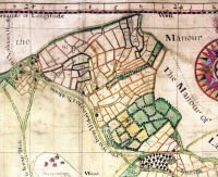
 A selection of parish, manorial and enclosure maps, listed below, are available on compact discs (CD).
Some of these maps relate to parishes for which there is no tithe map or the tithe map, because much of the land in the district was not subject to tithe, does not provide full coverage.
The CDs are £30 each (plus £4 postage and handling for UK; £7 Europe; £10 rest of world), payable by Visa/Mastercard/Debit card from the Surrey Heritage online shop. When you order, please ensure you tell us which map you would like. Alternatively, you can send a cheque made payable to 'Surrey County Council' to Surrey History Centre, 130 Goldsworth Road, Woking, Surrey GU21 6ND. If you are contacting us from outside the UK, please let us know your country of origin as changes in VAT legislation may affect the services we can provide.
There is one disc for each map, containing high resolution coloured digital images of the map, presented using software which allows you to navigate around the map and zoom in on sections. A transcript of the key to the map is provided where there is one.
These discs require Microsoft Windows to run.
All the material on the discs can be viewed in the search room at Surrey History Centre.
Map CDs
- Horsell Map by Edward Ryde 1851, reference 6198/11/188 (Map, transcript of key; and for further research an Excel spreadsheet containing Reference book data, digital images of the Reference Book and a comparison with the 1851 census.)
- Cobham Manor Map 1807, reference 2610/1/38/21 (Just the map which includes names and acreages; this map does not have a separate key.)
- Crowhurst Manor Map 1679, reference 6960/1 (Map, transcript of key; and for further research an Excel spreadsheet containing the transcript of the key in reference number order.)
- Ewell Enclosure Map 1802 and Award 1803, references 6054/1 and 8887/1 (Map, transcript of the Award and Award Schedule and images of the original Award; and for further research an Excel spreadsheet containing the Award Schedule data in plan number order.)
- Molesey East and West Enclosure Map 1821, reference QS6/4/30/1 (Map which includes names and acreages; this map does not have a separate key.)
- Molesey Matham and Molesey Prior Manors Map 1781, reference K81/3/1 (Map and transcript of the key; and for further research an Excel spreadsheet containing the transcript of the key in parcel number order.)
- Thorpe Manor Map 1809, reference 2675/81/11-12 (Map, transcript of the key and images of the original key; and for further research an Excel spreadsheet containing the transcript of the key in plan number order.)
- Woking Manor Map 1719, reference G97/5/63 (Map, transcript of key to the map and images of the original key; and for further research an Excel spreadsheet of the key.)

